⚠️ Disclosure: This post contains Amazon affiliate links. We may earn a commission at no extra cost to you.
Staying on track in the wilderness isn't rocket science if you've got these essential tips down pat. First, master your map and compass basics – they're your lifeline when your phone dies. Learn to spot natural direction markers like the sun's position and the North Star for backup navigation. Always stick to marked trails and actually pay attention to those colored blazes – they're there for a reason. Keep track of landmarks as you hike, and don't just blindly follow your buddy. And for heaven's sake, stay put if you get lost – wandering aimlessly will only make things worse. There's plenty more to know about wilderness navigation, and it could save your life.


Key Takeaways
- Always carry a physical map and compass as backup, even when using GPS devices, since electronics can fail outdoors.
- Learn to identify trail markers and their color codes before starting your hike to avoid getting lost.
- Practice basic compass skills in familiar areas before venturing into challenging wilderness terrain.
- Stay on marked trails and regularly cross-reference your location between the map and visible landmarks.
- If lost, stop immediately, stay calm, and use the sun's position to determine basic directions while waiting for help.
Map Reading Basics
While many novice campers rely on digital devices, mastering traditional map reading skills is essential for safe wilderness navigation. Let's face it – your phone will die eventually. Then what?
Here's what you need to know about map reading basics:
- Start with the scale. It's that little ruler-looking thing on your map. It shows you how distance on the map relates to actual ground distance. Pretty important when you're trying to figure out if that hike is really doable before sunset.
- Those squiggly contour lines? They're your best friends. They show elevation changes and help you understand the terrain. Trust me, you'll want to know if you're about to climb a mountain or descend into a valley.
- The compass rose isn't just a pretty decoration. It's your directional guide, showing you where north, south, east, and west are. Keep your map oriented in the direction you're facing – it's Navigation 101.
- Learn triangulation – it's not as complicated as it sounds. Find three landmarks you can see, locate them on your map, and boom – you've got your location.
Remember: Navigation skills could save your life. Don't be that person who gets lost because they couldn't be bothered to learn the basics.
Recommended Products

IN THE BOX: 1x Garmin Tread Overland GPS Navigator, 1x Suction cup mount, 1x Vehicle power cable, 1x Locking magnet-assisted mount, 1x USB-C cable, 1x Wearable4U E-Bank, 1x Car Charger, 1x Wall Charger, 1x microUSB charging cable

Bundle Includes: Garmin GPSMAP H1i Plus, Premium GPS Handheld Navigator with inReach Plus Technology to Share Texts, Photos, Voice Memos + USB3.0 to type-c female adapter Space Gray + USB Charging Adapter + Microfiber Cleaning Cloth + USB Type A to USB Type C cable
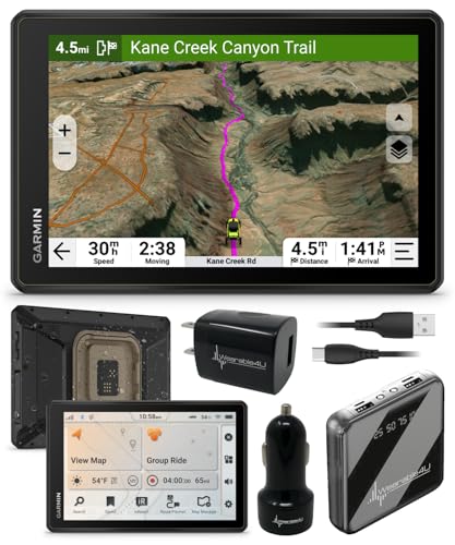
8” high-resolution, ultrabright and glove-friendly touchscreen navigator is purpose-built to withstand extreme temperatures and weather (IP67 dust/water rating) for rugged off-road adventures
Natural Direction Finding

Most seasoned campers know that when technology fails, Mother Nature provides reliable navigation tools. Let's face it – your fancy GPS won't help if those batteries die. But guess what? The sky above you is like a giant compass, and it's always working.
Here's what you need to know about not getting lost:
- The sun's your best friend. It rises in the east and sets in the west – super basic, but essential. Want to find Northeast? Just wait until morning and face the sunrise, then turn slightly left. Boom.
- Make a simple sun compass by sticking a tall stick in the ground and marking shadow positions throughout the day. Trust me, it works better than you'd think.
- At night, the North Star is your go-to navigation buddy. Find it, and you've found north. Period.
- Trees can be surprisingly chatty about directions. In the Northern Hemisphere, they'll often have thicker growth on their southern side. Nature's compass, right there.
Remember: cardinal directions aren't just fancy words on a map – they're your ticket to staying oriented. Getting lost isn't fun, but these natural navigation methods are surprisingly reliable. Just pay attention to what's around you.
Recommended Products

ASSEMBLED DIMENSIONS: 14.5 ft. W x 12 ft. D x 10 ft. H

Bundle includes TT 15 Dog Device – a top-mounted, high-sensitivity GPS/GLONASS receiver that uses 18 levels of continuous momentary stimulation, plus audible tone and vibration, activated from accompanying Alpha 200i Handheld
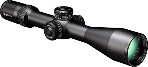
The Strike Eagle 5-25x56 First Focal Plane (MOA) scope provides the features needed to improve your long distance performance.
Using Your Compass Effectively
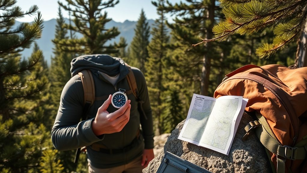
Once you've got your hands on a compass, using it correctly can mean the difference between a successful trek and an unplanned adventure. Let's face it – nobody wants to end up walking in circles because they can't figure out which way is north.
Here's what you absolutely must do for effective navigation:
- Keep that compass level and steady. Seriously, if the needle isn't floating freely, you might as well be using a paperweight for directions.
- Orient your map properly. Line up the compass's north arrow with magnetic north on your map. Trust me, this step is essential – skip it, and you'll be telling stories about that "shortcut" that turned into a three-hour detour.
When taking a bearing, rotate the compass housing until it aligns with your intended direction. Then just follow that direction arrow like it's your best friend. Simple, right?
Look, these skills need practice. Head to your local park and start mastering them now. Don't wait until you're lost in challenging terrain to figure out how your compass works. That's about as smart as learning to swim in a hurricane.
Remember: Check your heading regularly. The wilderness isn't exactly known for its street signs.
Recommended Products

Built for teaching: Complete 12-student kit for schools, camps, and SAR programs—everything needed to run hands-on map & compass lessons from indoors to field.

The Best Glide ASE Wilderness Survivor Survival Kit is one of the best equipped, premade survival kits. It includes an extensive selection of U.S. Military/Govt and/or NATO approved items.

Safety cord with scale.
Trail Markers and Waypoints

Anyone can follow a trail, but knowing how to read trail markers and waypoints is what separates the savvy campers from the lost ones. Let's face it – those colorful blazes and signs aren't just trail decoration. They're your lifeline in the wilderness, people.
Here's what you need to know about trail navigation:
- Color coding matters – different colors mean different trails or difficulty levels
- Waypoints are your best friends – they're specific spots you can use for GPS navigation
- Trail maps + markers = staying alive (yes, it's that simple)
When you're planning your route, don't just wing it. Cross-reference those trail markers with your map. Modern hiking paths use a mix of traditional markers and GPS waypoints, giving you double the navigation power. Smart, right?
Look, getting lost isn't fun. Before you head out on your outdoor experience, learn the local trail marker system. It's not rocket science, but it requires attention. Think of trail markers as your wilderness GPS – ignore them, and you might end up spending an unplanned night in the woods. Nobody wants that.
Recommended Products

BUNDLE INCLUDES: Garmin tactix 7 AMOLED Premium Tactical GPS Smartwatch, Signature Series Garmin Watch Charger Stand, and Signature Series Microfiber Lens Cloth

Features sunlight-readable 3.5” capacitive touchscreen display and a button-operated, dog-focused design for quick, minor adjustments
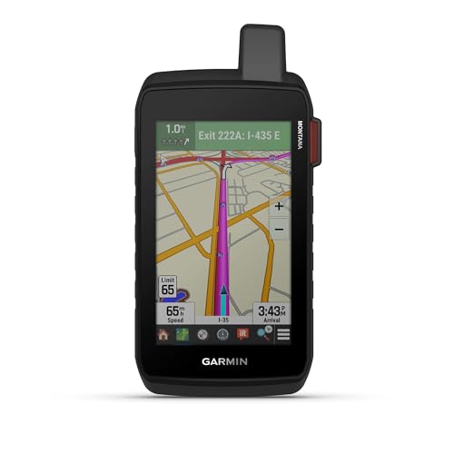
Rugged 5” handheld GPS navigator with inReach technology helps guide your adventures and keep you connected to loved ones when you go beyond the limits of cell service (active subscription required; some jurisdictions regulate or prohibit the use of satellite communication devices)
Emergency Navigation Techniques

The worst-case scenario for any camper is getting lost in unfamiliar territory. Let's face it – your fancy GPS app won't always save you when you're wandering in remote areas. That's why mastering emergency navigation techniques is non-negotiable.
First things first: if you're lost, stop moving. Like, right now. Getting more lost won't help anyone. Instead, assess your surroundings and try to recall your last known location. Basic map skills and a trusty compass are your best friends out there – no batteries required! And please, for the love of camping, always carry multiple navigation tools. Your smartphone dying in the wilderness? Not cool.
Here's what you need to know:
- The sun's your natural compass – rises east, sets west. Simple.
- Build a signal fire if you need rescue (just don't burn down the forest)
- Carry an emergency whistle – it's louder than your voice
- Master wilderness navigation basics before heading out
Recommended Products

Large 3” sunlight-readable color display for easy viewing

Our best selling model has now been upgraded! New upgrades include powerful 5 Watt Walkie Talkies. 5x more powerful than our previous walkie talkies. Our Solar Lantern has also been upgraded to LED COB Technology - Twice as bright as before!

Our best selling model has now been upgraded! New upgrades include powerful 5 Watt Walkie Talkies. 5x more powerful than our previous walkie talkies. Our Solar Lantern has also been upgraded to LED COB Technology - Twice as bright as before!
Frequently Asked Questions
Can I Set up Google Maps for an RV?
Just like a squirrel stashing nuts for winter, you'll want to plan ahead with Google Maps for your RV adventure. Yes, you can absolutely set it up! Start by entering your RV's dimensions in the settings, then focus on route planning with RV-friendly roads. You'll want to download maps for offline navigation (trust me, cell service can be spotty), search for campground finders, and mark scenic routes. Don't forget to check traffic alerts during your journey.
Is There an App for RV Routes?
Yes, you've got several great RV-specific navigation apps to choose from! RV LIFE Trip Wizard and CoPilot GPS are your best bets – they'll keep you from getting stuck under low bridges or on weight-restricted roads. These apps handle all your RV route planning needs and even work offline. For campground navigation, try AllStays or Roadtrippers. They're perfect for finding spots that'll fit your rig and have the amenities you need.
Does Waze Have an RV Setting?
No, Waze doesn't have a specific RV setting, which can be frustrating for your RV driving needs. While it's great for traffic considerations and GPS accuracy, you'll face navigation challenges with height restrictions and narrow roads. For safety tips and proper route planning, you're better off using dedicated RV apps that include campground directories and offline maps. Consider using Waze as a supplemental tool for real-time traffic, but not as your primary RV navigator.
What Is RV GPS?
Like a digital compass on steroids, RV GPS is your trusty road warrior designed specifically for recreational vehicles. You'll get specialized features that standard GPS units don't offer – it'll help you dodge those pesky low bridges and narrow roads that could turn your dream trip into a nightmare. It's packed with RV-specific route planning, camping locations, and off-grid navigation capabilities. Plus, you'll get safety tips and maintenance reminders tailored to your home-on-wheels.